
The World Shipping Council (WSC) has launched the world’s first global navigational aid to protect whales.
The WSC Whale Chart, available for free, is the first global mapping of all mandatory and voluntary governmental measures to reduce harm to whales from ships. It will be regularly updated.
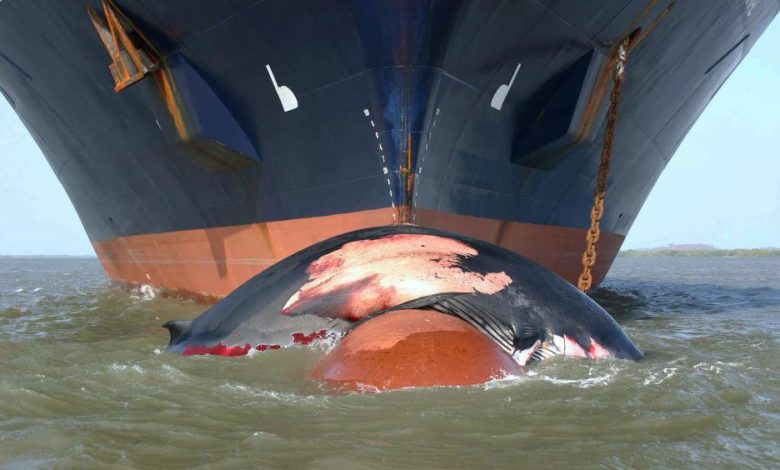
Experience shows that separating ships and whales is the most effective way to limit ship strikes. In areas where separation is not possible, speed reductions can help mitigate the risk. Hence, there are numerous international, regional, national and local regulations and recommendations addressing areas to be avoided, routing measures, and speed restrictions for seafarers to keep track of as they navigate the globe.
“With the WSC Whale Chart, seafarers will for the first time have a comprehensive global resource offering critical navigational coordinates and concise graphics to identify routing measures and areas subject to static speed restrictions designed to protect whales and other cetaceans. We hope that by compiling this unique navigational aid, keeping it updated and making it available for free to all navigators, we can help reduce ship strikes and safeguard endangered whale populations across the globe,” said John Butler, president of the WSC, a lobby group for liner shipping based in Washington DC.
Experts working for the NGO Friend of the Sea estimate that cargo, cruise, and fishing vessels collide and kill at least 20,000 whales every year.